Senex Maps Collection Beautifully Charts the Known (and Unknown) World
By Trevor Bond, WSU Libraries Dean
In the dim glow of an early 18th-century London workshop, a young John Senex bent over a copper plate, carving lines that would soon become rivers, roads, and the edges of the known world. After his lengthy apprenticeship, beneath a sign that read The Globe against St. Dunstan’s Church, Senex and his name became a quiet guarantee of precision and ambition. “Engraved by Iohn Senex and sold by him at the Globe,” his maps declared, as though each sheet were both a record and an invitation. Travelers, scholars, and curious minds paused before his shop, tracing imagined journeys across inked coastlines and carefully ruled roads.
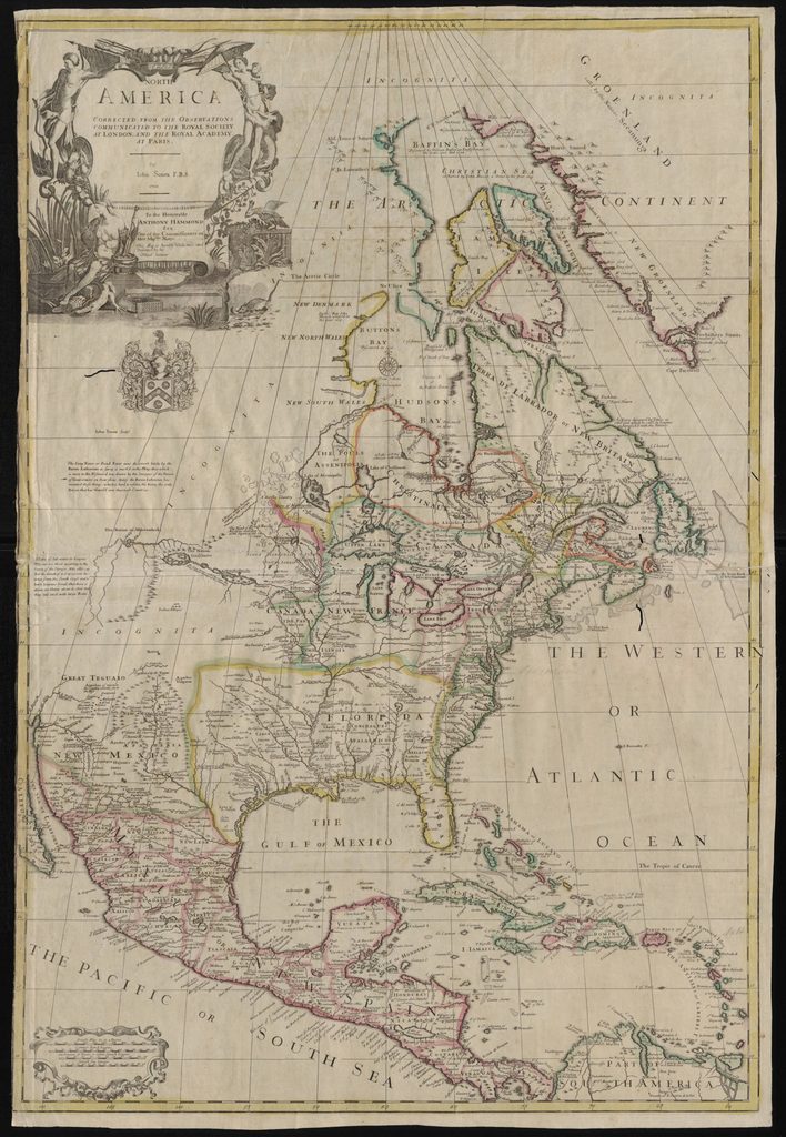
The 33 Senex maps in WSU Libraries’ Manuscripts, Archives, and Special Collections (MASC), originally published as The Universal Geographer (1725), showcase the artistry of his engravings and reflect a time centuries before satellites and GPS, when cartographers worked from observation, exploration, and educated guesses about unknown regions. Today, we can marvel at these beautifully crafted maps and the stories they tell—not just of places, but of the limits of human knowledge. On one map of North America, vast stretches are labeled Incognita, and California appears as an island.
Senex worked alongside some of the greatest scientific minds of his time. With astronomer and mathematician Edmund Halley, he plotted the arc of a comet that would later bear Halley’s name, and he printed star charts that turned the night sky into a navigable sea. After Senex’s death in 1740, the story did not end. On Fleet Street, his wife Mary continued the business, preserving his name and selling his globes and maps until 1755.
How did such a remarkable collection of maps, printed between 1705 and 1725, end up at Washington State University?
That question led me back into the MASC rare book vault, where I examined the maps again. There were no pencil notes—only an accession number on the sheets themselves. I checked the MASC card catalog, which still preserves shelf cards for The Universal Geographer, but it offered no additional clues.
I asked my colleagues Mark O’English, university archivist, and Cheryl Gunselman, retired manuscripts librarian, for help. One suggested consulting our conservator, Linnea Rash, who located images from the maps’ earlier treatment (flattening and cleaning) and a written annotation dated 1954 with a price of $100. The 1954 date aligns with the range of accession numbers associated with the collection, suggesting that the atlas was purchased, perhaps by the library or a collector who later donated it to WSU. Adjusted for inflation, that $100 would be roughly $1,500 today, still a remarkable price for the hand-colored maps.
The story of these maps continues. They became more accessible online after Jesslyn Starnes, then a WSU graduate student, worked with scans of the collection to create metadata and a front page during the summer of 2020, supported by a Jewett Foundation graduate fellowship in MASC. Greg Matthews, metadata librarian, and Suzanne James-Bacon, electronic resources coordinator, consulted with Starnes on the metadata. You can view the maps online, or better yet, see them in person by emailing MASC for an appointment.